GeoMaster
GeoMaster is an advanced geosteering software created to change the way drilling activities are carried out in the oil and gas sector. With an emphasis on smooth incorporation of data and tools, it allows drilling engineers and geoscientists to make quicker, more knowledgeable decisions, ultimately lowering drilling risks and improving wellbore placement. GeoMaster is crafted to provide accuracy and versatility, allowing for immediate adjustments to the wellbore path in order to maintain efficiency and accuracy during drilling operations. The software provides a range of features that help users analyze data from different sources, change well paths during drilling, and improve drilling success rates by incorporating advanced geosteering techniques like model-based and strat-based approaches. Constructed with a user-friendly, online interface, GeoMaster enables simple access and collaboration from any place, proving to be an effective tool for contemporary drilling activities. GeoMaster provides users with the opportunity to easily adjust its design and select cloud-based data storage if desired. This flexibility in deployment options allows for scaling operations without requiring a large IT infrastructure. Whether you are in charge of one well or supervising a significant field project, GeoMaster offers a subscription service suitable for small teams and large companies.

Key Features
Standout features of our Geosteering software
WITSML Data Streaming
Seamlessly integrate real-time drilling data using WITSML for data integration and decision-making.
Show more
Model-Based Geosteering Enhancements
Dynamic Log Creation: Generates adaptive logs based on reference logs, allowing users to adapt to changing subsurface conditions.
Show more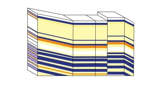
Strat-Based Geosteering
Active Log Correlation: Implement a mechanism to correlate the Geosteering well log with a predefined type well log, enhancing accuracy and reliability. Segment-by-Segment Adjustment: Enable stretching and squeezing of logs segment by segment for precise geosteering control and optimization.
Show more
Subscription-Based Model
Offer a flexible subscription-based pricing model, providing users with scalable options that align with their project needs and budget constraints.
Show more
Optional Web-Based Access
Provide an optional web-based access feature, allowing users to access the software remotely from any location with an internet connection. This feature enhances accessibility and collaboration, particularly for geoscientists and engineers working in distributed teams or remote locations.
Show more
Optional Cloud-Based Access
Transition to a cloud-based model for ensuring scalability and ease of collaboration for users across different locations.
Show more